Geolocate

Torlundy topographic map

Click on the map to display elevation.

About this map

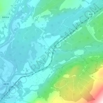
Name: Torlundy topographic map, elevation, terrain.

Location: Torlundy, Highland, Scotland, PH33 6SS, United Kingdom (56.82781 -5.06432 56.86781 -5.02432)

Average elevation: 295 ft

Minimum elevation: 0 ft

Maximum elevation: 1,798 ft

Gear up for your next adventure:

🎒Trekking Poles - Sturdy poles for balance and stability on rough terrain
🎒Hydration Pack - Hands‑free water reservoir for long hikes
🗺️Topographic Maps - Detailed topo maps for hiking, exploring and outdoor navigation
📌Outdoor GPS Map App - Apps and devices for digital topographic navigation
🛌Ultralight Sleeping Bags - Compact down bags for cold nights in the wilderness

As an Amazon Associate, this site earns from qualifying purchases at no extra cost to you.