Geolocate

Whitland topographic map

Click on the map to display elevation.

About this map

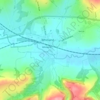
Name: Whitland topographic map, elevation, terrain.

Location: Whitland, Carmarthenshire, Wales, SA34 0QE, United Kingdom (51.81578 -4.61423 51.81734 -4.61275)

Average elevation: 141 ft

Minimum elevation: 43 ft

Maximum elevation: 407 ft

Gear up for your next adventure:

🧣Merino Neck Gaiters - Multi-functional headwear for wind and sun protection
🛰️Handheld GPS Units - Professional satellite navigators for precise backcountry mapping
🥾Hiking Shoes - Durable and comfortable shoes for trail hiking
🔦Powerful Headlamps - Ultra-bright hands-free lighting for night navigation
🏫Relief Map Kits - Hands-on tools for teaching landforms and elevation

As an Amazon Associate, this site earns from qualifying purchases at no extra cost to you.