
Taylor topographic map
Click on the map to display elevation.
About this map
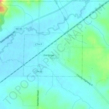
Name: Taylor topographic map, elevation, terrain.
Location: Taylor, Jackson County, Wisconsin, United States (44.31642 -91.13076 44.32731 -91.11023)
Average elevation: 899 ft
Minimum elevation: 866 ft
Maximum elevation: 1,063 ft
Jackson County trails, hiking, mountain biking, running and outdoor activities