
Thank you for supporting this site ❤️
Make a donation
Make a donation
Gear up for your next adventure:
As an Amazon Associate, this site earns from qualifying purchases at no extra cost to you.
Tirino topographic map
Click on the map to display elevation.
Thank you for supporting this site ❤️
Make a donation
Make a donation
Gear up for your next adventure:
As an Amazon Associate, this site earns from qualifying purchases at no extra cost to you.
About this map
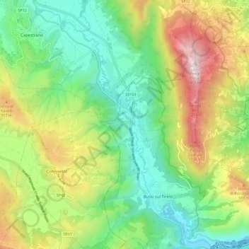
Name: Tirino topographic map, elevation, terrain.
Location: Tirino, Bussi sul Tirino, Pescara, Abruzzo, 65022, Italia (42.19540 13.77169 42.27934 13.85245)
Average elevation: 2,116 ft
Minimum elevation: 755 ft
Maximum elevation: 4,531 ft
Thank you for supporting this site ❤️
Make a donation
Make a donation
Gear up for your next adventure:
As an Amazon Associate, this site earns from qualifying purchases at no extra cost to you.