
Britton Davis topographic map
Click on the map to display elevation.
About this map
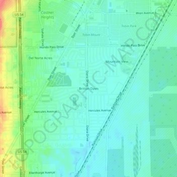
Name: Britton Davis topographic map, elevation, terrain.
Average elevation: 3,911 ft
Minimum elevation: 3,858 ft
Maximum elevation: 4,062 ft
El Paso County trails, hiking, mountain biking, running and outdoor activities
Other topographic maps
Click on a map to view its topography, its elevation and its terrain.
Franklin Mountains State Park
United States > Texas > El Paso County > El Paso
Franklin Mountains State Park is a Texas state park in El Paso, Texas, that protects the Franklin Mountains. Park headquarters are located at an elevation of 5,426 feet (1,654 m) with the highest peak, North Franklin Mountain, reaching 7,192 feet (2,192 m). It is one of the largest urban parks in the nation…
Average elevation: 4,242 ft