
Bay topographic map
Click on the map to display elevation.
About this map
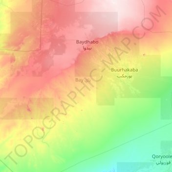
Name: Bay topographic map, elevation, terrain.
Location: Bay, Burhakaba District, Bay, South West, Somalia (1.63660 42.62938 3.63660 44.62938)
Average elevation: 866 ft
Minimum elevation: 184 ft
Maximum elevation: 2,277 ft