
Thank you for supporting this site ❤️
Make a donation
Make a donation
Gear up for your next adventure:
As an Amazon Associate, this site earns from qualifying purchases at no extra cost to you.
Beendorf topographic map
Click on the map to display elevation.
Thank you for supporting this site ❤️
Make a donation
Make a donation
Gear up for your next adventure:
As an Amazon Associate, this site earns from qualifying purchases at no extra cost to you.
About this map
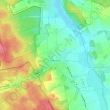
Name: Beendorf topographic map, elevation, terrain.
Location: Beendorf, Flechtingen, Börde, Saksen-Anhalt, Duitsland (52.22826 11.05222 52.26194 11.10461)
Average elevation: 440 ft
Minimum elevation: 328 ft
Maximum elevation: 610 ft
Thank you for supporting this site ❤️
Make a donation
Make a donation
Gear up for your next adventure:
As an Amazon Associate, this site earns from qualifying purchases at no extra cost to you.