
Thank you for supporting this site ❤️
Make a donation
Make a donation
Gear up for your next adventure:
As an Amazon Associate, this site earns from qualifying purchases at no extra cost to you.
Mahfouda topographic map
Click on the map to display elevation.
Thank you for supporting this site ❤️
Make a donation
Make a donation
Gear up for your next adventure:
As an Amazon Associate, this site earns from qualifying purchases at no extra cost to you.
About this map
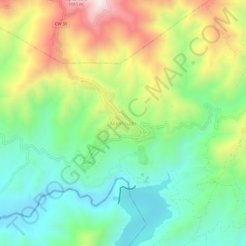
Name: Mahfouda topographic map, elevation, terrain.
Location: Mahfouda, Bouhamza, Daïra Seddouk, Béjaïa, 06031, Algérie (36.42009 4.63130 36.46009 4.67130)
Average elevation: 1,624 ft
Minimum elevation: 758 ft
Maximum elevation: 3,117 ft
Thank you for supporting this site ❤️
Make a donation
Make a donation
Gear up for your next adventure:
As an Amazon Associate, this site earns from qualifying purchases at no extra cost to you.