
Thank you for supporting this site ❤️
Make a donation
Make a donation
Gear up for your next adventure:
As an Amazon Associate, this site earns from qualifying purchases at no extra cost to you.
Sankagiri topographic map
Click on the map to display elevation.
Thank you for supporting this site ❤️
Make a donation
Make a donation
Gear up for your next adventure:
As an Amazon Associate, this site earns from qualifying purchases at no extra cost to you.
About this map
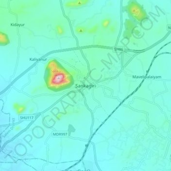
Name: Sankagiri topographic map, elevation, terrain.
Location: Sankagiri, Sankari, Salem, Tamil Nadu, 637300, India (11.43609 77.83040 11.51609 77.91040)
Average elevation: 974 ft
Minimum elevation: 787 ft
Maximum elevation: 2,323 ft
Thank you for supporting this site ❤️
Make a donation
Make a donation
Gear up for your next adventure:
As an Amazon Associate, this site earns from qualifying purchases at no extra cost to you.