
Make a donation
Gear up for your next adventure:
As an Amazon Associate, this site earns from qualifying purchases at no extra cost to you.
Haleys Corner topographic map
Click on the map to display elevation.
Make a donation
Gear up for your next adventure:
As an Amazon Associate, this site earns from qualifying purchases at no extra cost to you.
About this map
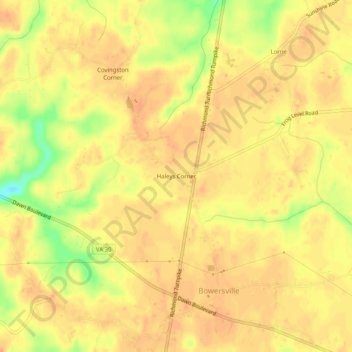
Name: Haleys Corner topographic map, elevation, terrain.
Location: Haleys Corner, Caroline County, Virginia, United States (37.82820 -77.38915 37.86820 -77.34915)
Average elevation: 197 ft
Minimum elevation: 102 ft
Maximum elevation: 223 ft
Caroline County trails, hiking, mountain biking, running and outdoor activities
Make a donation
Gear up for your next adventure:
As an Amazon Associate, this site earns from qualifying purchases at no extra cost to you.
Other topographic maps
Click on a map to view its topography, its elevation and its terrain.
Mattaponi Wildlife Management Area
United States > Virginia > Caroline County
Average elevation: 141 ft