
Thank you for supporting this site ❤️
Make a donation
Make a donation
Gear up for your next adventure:
As an Amazon Associate, this site earns from qualifying purchases at no extra cost to you.
Dharma topographic map
Click on the map to display elevation.
Thank you for supporting this site ❤️
Make a donation
Make a donation
Gear up for your next adventure:
As an Amazon Associate, this site earns from qualifying purchases at no extra cost to you.
About this map
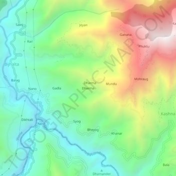
Name: Dharma topographic map, elevation, terrain.
Location: Dharma, Theog, Shimla, Himachal Pradesh, 171226, India (31.00797 77.37148 31.04797 77.41148)
Average elevation: 5,167 ft
Minimum elevation: 3,632 ft
Maximum elevation: 7,920 ft
Thank you for supporting this site ❤️
Make a donation
Make a donation
Gear up for your next adventure:
As an Amazon Associate, this site earns from qualifying purchases at no extra cost to you.