Geolocate

Algester topographic map

Click on the map to display elevation.

About this map

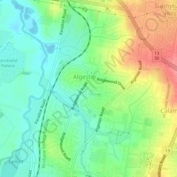
Name: Algester topographic map, elevation, terrain.

Location: Algester, City of Brisbane, Queensland, Australia (-27.62867 153.02266 -27.59751 153.04301)

Average elevation: 121 ft

Minimum elevation: 16 ft

Maximum elevation: 295 ft

Other topographic maps

Click on a map to view its topography, its elevation and its terrain.

Enoggera Hill

Australia > Queensland > City of Brisbane

Average elevation: 374 ft

Toohey Mountain

Australia > Queensland > City of Brisbane

Average elevation: 174 ft

Blunder Creek

Australia > Queensland > City of Brisbane

Average elevation: 85 ft

Tangalooma

Australia > Queensland > City of Brisbane

Average elevation: 135 ft

Timberland Park

Australia > Queensland > City of Brisbane

Average elevation: 121 ft

Deepwater Bend

Australia > Queensland > City of Brisbane

Average elevation: 16 ft

Tangalooma

Australia > Queensland > City of Brisbane

Average elevation: 135 ft

Gear up for your next adventure:

🔦LED Headlamp - Bright and durable LED headlamp for night navigation
🧣Hiking Neck Gaiter - Multi‑use neck protection for outdoor weather
🧭Map Reading Tools - Tools and kits for map navigation
Camping Coffee Makers - Enjoy premium coffee at the summit or campsite
🎁Geography Themed Gifts - Unique gift ideas for map lovers and geography enthusiasts

As an Amazon Associate, this site earns from qualifying purchases at no extra cost to you.