
Ocean Pines topographic map
Click on the map to display elevation.
About this map
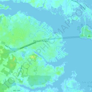
Name: Ocean Pines topographic map, elevation, terrain.
Location: Ocean Pines, Worcester County, Maryland, United States (38.35826 -75.18678 38.40950 -75.10656)
Average elevation: 10 ft
Minimum elevation: -13 ft
Maximum elevation: 56 ft
Worcester County trails, hiking, mountain biking, running and outdoor activities