
Tixcacalcupul topographic map
Interactive map
Click on the map to display elevation.
About this map
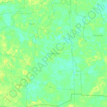
Name: Tixcacalcupul topographic map, elevation, terrain.
Location: Tixcacalcupul, Yucatán, Mexico (20.25177 -88.45932 20.57293 -88.21648)
Average elevation: 79 ft
Minimum elevation: 62 ft
Maximum elevation: 108 ft
Other topographic maps
Click on a map to view its topography, its elevation and its terrain.
Palomar
Mexico > Yucatán > Valladolid
Palomar, Valladolid, Yucatán, 97785, Mexico
Average elevation: 69 ft
Chicxulub Puerto
Mexico > Yucatán > Progreso > Chicxulub Puerto
Chicxulub Puerto, Progreso, Yucatán, Mexico
Average elevation: 0 ft
San Felipe Nuevo
San Felipe Nuevo, Tinum, Yucatán, 97751, Mexico
Average elevation: 89 ft