Geolocate

Cuispes topographic map

Click on the map to display elevation.

About this map

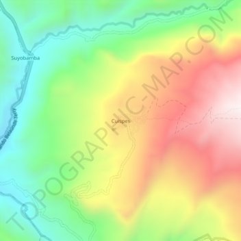
Name: Cuispes topographic map, elevation, terrain.

Location: Cuispes, Bongará, Amazonas, Perú (-5.94820 -77.96586 -5.90820 -77.92586)

Average elevation: 5,663 ft

Minimum elevation: 4,390 ft

Maximum elevation: 7,247 ft

Gear up for your next adventure:

🪶Wildlife Field Guides - Learn animal tracking and species ID
📡Handheld GPS Device - Reliable handheld GPS for outdoor navigation
🪶Camp Gear Gift Set - Perfect gift bundle for outdoor fans
🚑Emergency Bivvies - Heat-reflective sleeping bags for survival situations
📷Action Cameras - Rugged cameras to document your journeys across rugged terrain

As an Amazon Associate, this site earns from qualifying purchases at no extra cost to you.