Geolocate

Troy topographic map

Click on the map to display elevation.

About this map

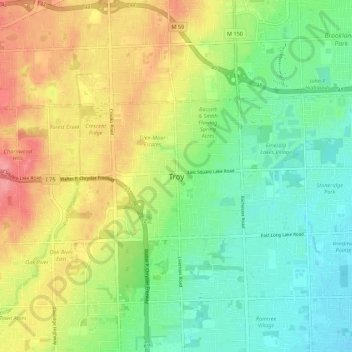
Name: Troy topographic map, elevation, terrain.

Location: Troy, Oakland County, Michigan, 48085:48098, United States (42.56559 -83.18993 42.64559 -83.10993)

Average elevation: 751 ft

Minimum elevation: 643 ft

Maximum elevation: 909 ft

Gear up for your next adventure:

GPS Sports Watch - GPS watch for running, hiking and training
🧤Tactile Hiking Gloves - Keep hands warm while operating GPS and smartphone screens
🧦Merino Wool Socks - Moisture-wicking, blister-preventing socks for long treks
🧢Outdoor Hiking Hat - Sun protection hat for outdoor explorers
🌧️Backpack Rain Cover - Keep gear dry in wet weather

As an Amazon Associate, this site earns from qualifying purchases at no extra cost to you.