Geolocate

Omen topographic map

Click on the map to display elevation.

About this map

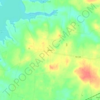
Name: Omen topographic map, elevation, terrain.

Location: Omen, Smith County, Texas, 75750, United States (32.19738 -95.12411 32.23738 -95.08411)

Average elevation: 443 ft

Minimum elevation: 361 ft

Maximum elevation: 551 ft

Smith County trails, hiking, mountain biking, running and outdoor activities

Gear up for your next adventure:

🌄Hiking Binoculars - Compact binoculars for scenic views and trail spotting
🔪Outdoor Multitools - Essential survival tools for gear repair and field use
🛏️Cold Weather Sleeping Bag - Warm sleeping bag for cold conditions
💧Water Filtration Bottles - Safely drink from streams and lakes while exploring
🦺Reflective Outdoor Gear - Safety gear for low‑light conditions

As an Amazon Associate, this site earns from qualifying purchases at no extra cost to you.