
Thank you for supporting this site ❤️
Make a donation
Make a donation
Gear up for your next adventure:
As an Amazon Associate, this site earns from qualifying purchases at no extra cost to you.
Corong-Corong topographic map
Click on the map to display elevation.
Thank you for supporting this site ❤️
Make a donation
Make a donation
Gear up for your next adventure:
As an Amazon Associate, this site earns from qualifying purchases at no extra cost to you.
About this map
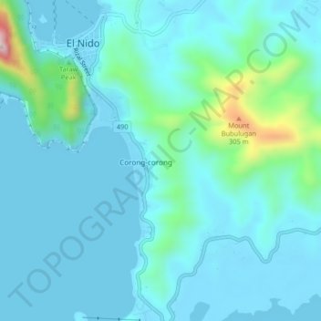
Name: Corong-Corong topographic map, elevation, terrain.
Location: Corong-Corong, Palawan, Mimaropa, 5313, Philippines (11.14533 119.38038 11.18533 119.42038)
Average elevation: 187 ft
Minimum elevation: -3 ft
Maximum elevation: 1,391 ft
Thank you for supporting this site ❤️
Make a donation
Make a donation
Gear up for your next adventure:
As an Amazon Associate, this site earns from qualifying purchases at no extra cost to you.