
Make a donation
Gear up for your next adventure:
As an Amazon Associate, this site earns from qualifying purchases at no extra cost to you.
Gardênia Azul topographic map
Click on the map to display elevation.
Make a donation
Gear up for your next adventure:
As an Amazon Associate, this site earns from qualifying purchases at no extra cost to you.
About this map
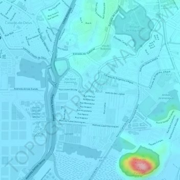
Name: Gardênia Azul topographic map, elevation, terrain.
Average elevation: 43 ft
Minimum elevation: -7 ft
Maximum elevation: 610 ft
Make a donation
Gear up for your next adventure:
As an Amazon Associate, this site earns from qualifying purchases at no extra cost to you.
Other topographic maps
Click on a map to view its topography, its elevation and its terrain.
Make a donation
Gear up for your next adventure:
As an Amazon Associate, this site earns from qualifying purchases at no extra cost to you.
Morro Dois Irmãos (Maciço da Pedra Branca)
Brasil > Rio de Janeiro > Rio de Janeiro
Average elevation: 138 ft
Make a donation
Gear up for your next adventure:
As an Amazon Associate, this site earns from qualifying purchases at no extra cost to you.
Morro Dois Irmãos
Brasil > Rio de Janeiro > Rio de Janeiro
Morro Dois Irmãos é uma formação rochosa no bairro do Vidigal, no Rio de Janeiro. Seu topo com 533 metros de altitude acima do nível do mar é mais alto que o Pão de Açúcar (395 m) porém inferior ao Corcovado (704 m) este pode ser atingido por meio de uma trilha de 1,5 km de extensão. Também no…
Average elevation: 354 ft
Make a donation
Gear up for your next adventure:
As an Amazon Associate, this site earns from qualifying purchases at no extra cost to you.
Praia da Macumba
Brasil > Rio de Janeiro > Rio de Janeiro
A formação do Recreio se daria a 11 de fevereiro de 1953 com o lançamento do Projeto de Urbanização do Recreio dos Bandeirantes (PA 6028), de autoria do engenheiro e urbanista José Otacílio Saboya Ribeiro, num projeto urbano que prevê a integração ambiental e comunitária, inspirado nos ideais…
Average elevation: 43 ft
Make a donation
Gear up for your next adventure:
As an Amazon Associate, this site earns from qualifying purchases at no extra cost to you.