
Jumièges topographic map
Interactive map
Click on the map to display elevation.
About this map
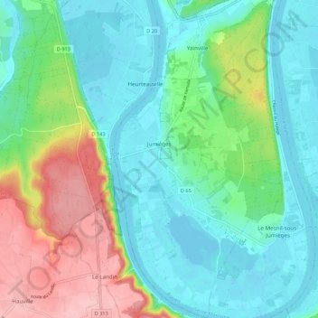
Name: Jumièges topographic map, elevation, terrain.
Average elevation: 144 ft
Minimum elevation: -7 ft
Maximum elevation: 492 ft
Other topographic maps
Click on a map to view its topography, its elevation and its terrain.
Le Tilleul - Antifer
France > Normandy > Seine-Maritime > La Poterie-Cap-d'Antifer
Average elevation: 138 ft