
Шаманка topographic map
Interactive map
Click on the map to display elevation.
About this map
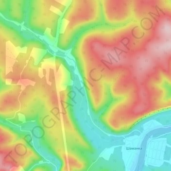
Name: Шаманка topographic map, elevation, terrain.
Average elevation: 1,988 ft
Minimum elevation: 1,545 ft
Maximum elevation: 2,484 ft
Other topographic maps
Click on a map to view its topography, its elevation and its terrain.
Моты
Russia > Irkutsk Oblast > Шаманское сельское поселение
Моты, Шаманское сельское поселение, Шелеховский район, Irkutsk Oblast, Siberian Federal District, Russia
Average elevation: 1,686 ft