
Slavske Settlement Hromada topographic map
Interactive map
Click on the map to display elevation.
About this map
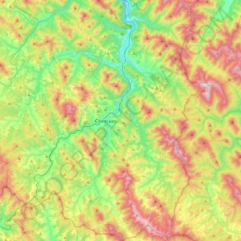
Name: Slavske Settlement Hromada topographic map, elevation, terrain.
Location: Slavske Settlement Hromada, Stryi Raion, Lviv Oblast, Ukraine (48.71828 23.24124 48.97158 23.60768)
Average elevation: 2,736 ft
Minimum elevation: 1,627 ft
Maximum elevation: 4,409 ft
Other topographic maps
Click on a map to view its topography, its elevation and its terrain.