
Millwood Park topographic map
Interactive map
Click on the map to display elevation.
About this map
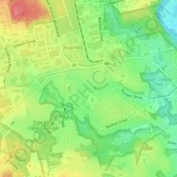
Name: Millwood Park topographic map, elevation, terrain.
Average elevation: 1,030 ft
Minimum elevation: 909 ft
Maximum elevation: 1,181 ft
Other topographic maps
Click on a map to view its topography, its elevation and its terrain.
Huron Natural Area
Canada > Ontario > Region of Waterloo > Kitchener
Huron Natural Area, Kitchener, Region of Waterloo, Southwestern Ontario, Ontario, Canada
Average elevation: 1,109 ft
Steckle Woods
Canada > Ontario > Region of Waterloo > Kitchener
Steckle Woods, Primrose Path, Country Hills, Kitchener, Region of Waterloo, Southwestern Ontario, Ontario, N2E 2N1, Canada
Average elevation: 1,063 ft