Geolocate

Prairieville topographic map

Click on the map to display elevation.

About this map

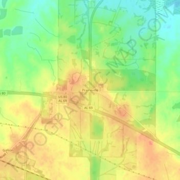
Name: Prairieville topographic map, elevation, terrain.

Location: Prairieville, Hale County, Alabama, United States (32.49014 -87.71445 32.53014 -87.67445)

Average elevation: 167 ft

Minimum elevation: 85 ft

Maximum elevation: 226 ft

Hale County trails, hiking, mountain biking, running and outdoor activities

Gear up for your next adventure:

🔦Powerful Headlamps - Ultra-bright hands-free lighting for night navigation
🚑Emergency Bivvies - Heat-reflective sleeping bags for survival situations
🧭Outdoor Navigation Book - Learn advanced navigation skills
🗺️Topographic Maps - Detailed topo maps for hiking, exploring and outdoor navigation
🚪Portable Camp Chair - Foldable chair for comfort at camp

As an Amazon Associate, this site earns from qualifying purchases at no extra cost to you.