
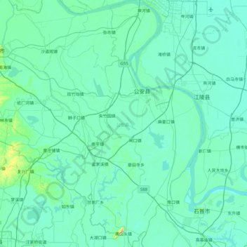
公安县 topographic map
Interactive map
Click on the map to display elevation.
About this map
Name: 公安县 topographic map, elevation, terrain.
Location: 公安县, 荆州市, 湖北省, 434300, 中国 (29.62006 111.80451 30.31577 112.42395)
Average elevation: 118 ft
Minimum elevation: 66 ft
Maximum elevation: 804 ft
公安县地处江汉平原,多数地区为平原湖区,仅西南部为平岗与丘陵。其中虎渡河由北向南贯穿全境,将县境分为虎东、虎西两部分。地面平均海拔约为36米。
Other topographic maps
Click on a map to view its topography, its elevation and its terrain.