
Thank you for supporting this site ❤️
Make a donation
Make a donation
Gear up for your next adventure:
As an Amazon Associate, this site earns from qualifying purchases at no extra cost to you.
Lake Arpi topographic map
Click on the map to display elevation.
Thank you for supporting this site ❤️
Make a donation
Make a donation
Gear up for your next adventure:
As an Amazon Associate, this site earns from qualifying purchases at no extra cost to you.
About this map
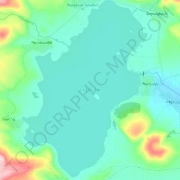
Name: Lake Arpi topographic map, elevation, terrain.
Location: Lake Arpi, Tsaghkut, Amasia region, Shirak Province, Armenia (41.02792 43.59152 41.09601 43.65567)
Average elevation: 6,729 ft
Minimum elevation: 6,558 ft
Maximum elevation: 7,411 ft
Thank you for supporting this site ❤️
Make a donation
Make a donation
Gear up for your next adventure:
As an Amazon Associate, this site earns from qualifying purchases at no extra cost to you.