Geolocate

Barongis topographic map

Click on the map to display elevation.

About this map

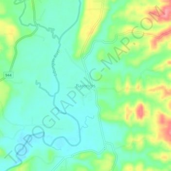
Name: Barongis topographic map, elevation, terrain.

Location: Barongis, North Cotabato, Soccsksargen, Philippines (7.24207 124.54336 7.28207 124.58336)

Average elevation: 167 ft

Minimum elevation: 69 ft

Maximum elevation: 384 ft

Gear up for your next adventure:

🌄Hiking Binoculars - Compact binoculars for scenic views and trail spotting
🧦Hiking Socks - Comfortable socks to prevent blisters on long hikes
🧭Pro Hiking Compasses - High-accuracy liquid-filled compasses for topographic orientation
Backpacking Tent - Lightweight and durable tent for multi‑day hikes
🕶️GPS Smartphone Mount - Secure mount for phone navigation

As an Amazon Associate, this site earns from qualifying purchases at no extra cost to you.