Geolocate

Windom topographic map

Interactive map

Click on the map to display elevation.

About this map

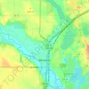
Name: Windom topographic map, elevation, terrain.

Location: Windom, Cottonwood County, Minnesota, United States (43.85162 -95.16429 43.89849 -95.09550)

Average elevation: 1,394 ft

Minimum elevation: 1,339 ft

Maximum elevation: 1,470 ft

Other topographic maps

Click on a map to view its topography, its elevation and its terrain.

Bingham Lake

United States > Minnesota > Cottonwood County

Bingham Lake, Cottonwood County, Minnesota, United States

Average elevation: 1,407 ft

Jeffers

United States > Minnesota > Cottonwood County

Jeffers, Cottonwood County, Minnesota, United States

Average elevation: 1,476 ft

Storden

United States > Minnesota > Cottonwood County

Storden, Cottonwood County, Minnesota, United States

Average elevation: 1,388 ft

Westbrook

United States > Minnesota > Cottonwood County

Westbrook, Cottonwood County, Minnesota, United States

Average elevation: 1,430 ft

Mountain Lake

United States > Minnesota > Cottonwood County

Mountain Lake, Cottonwood County, Minnesota, United States

Average elevation: 1,293 ft