Geolocate

Huntington topographic map

Click on the map to display elevation.

About this map

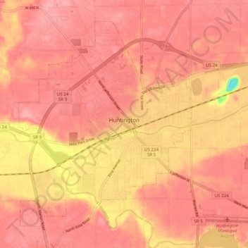
Name: Huntington topographic map, elevation, terrain.

Location: Huntington, Huntington County, Indiana, 46750, United States (40.85125 -85.53905 40.91244 -85.44128)

Average elevation: 781 ft

Minimum elevation: 512 ft

Maximum elevation: 860 ft

Huntington County trails, hiking, mountain biking, running and outdoor activities

Other topographic maps

Click on a map to view its topography, its elevation and its terrain.

Mahon

United States > Indiana > Huntington County

Average elevation: 781 ft

Mahon

United States > Indiana > Huntington County

Average elevation: 781 ft

Gear up for your next adventure:

🔊Portable Camp Speaker - Music and alerts at camp
🌲Outdoor Survival Books - Best books on survival skills
🪶Survival Guide Book - Expert advice for emergency preparedness
🕶️GPS Smartphone Mount - Secure mount for phone navigation
🎒Hydration Pack - Hands‑free water reservoir for long hikes

As an Amazon Associate, this site earns from qualifying purchases at no extra cost to you.