Geolocate

Talon topographic map

Click on the map to display elevation.

About this map

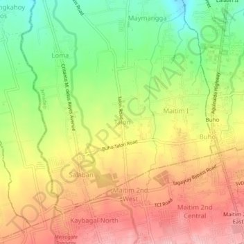
Name: Talon topographic map, elevation, terrain.

Location: Talon, Amadeo, Cavite, Calabarzon, 4119, Philippines (14.11826 120.92015 14.15826 120.96015)

Average elevation: 1,749 ft

Minimum elevation: 1,480 ft

Maximum elevation: 1,995 ft

Gear up for your next adventure:

🧭Pro Hiking Compasses - High-accuracy liquid-filled compasses for topographic orientation
☀️Outdoor Sunscreen - High protection sunscreen for outdoor activities
🚁Photography Drones - Capture stunning aerial views of landforms and topography
📡Handheld GPS Device - Reliable handheld GPS for outdoor navigation
🧺Microfiber Travel Towels - Compact and fast-drying towels for trail use

As an Amazon Associate, this site earns from qualifying purchases at no extra cost to you.