
Dover Island topographic map
Interactive map
Click on the map to display elevation.
About this map
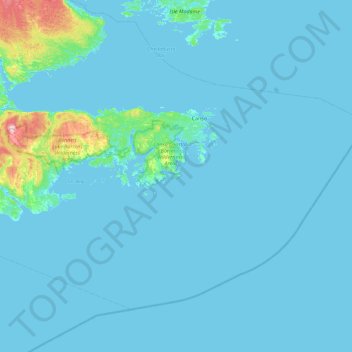
Name: Dover Island topographic map, elevation, terrain.
Average elevation: 39 ft
Minimum elevation: -7 ft
Maximum elevation: 755 ft
Other topographic maps
Click on a map to view its topography, its elevation and its terrain.
White Head Island
Canada > Nova Scotia > Dover
White Head Island, Dover, Guysborough District Municipality, Guysborough County, Nova Scotia, Canada
Average elevation: 49 ft