
Thank you for supporting this site ❤️
Make a donation
Make a donation
Gear up for your next adventure:
As an Amazon Associate, this site earns from qualifying purchases at no extra cost to you.
Cikeruh topographic map
Click on the map to display elevation.
Thank you for supporting this site ❤️
Make a donation
Make a donation
Gear up for your next adventure:
As an Amazon Associate, this site earns from qualifying purchases at no extra cost to you.
About this map
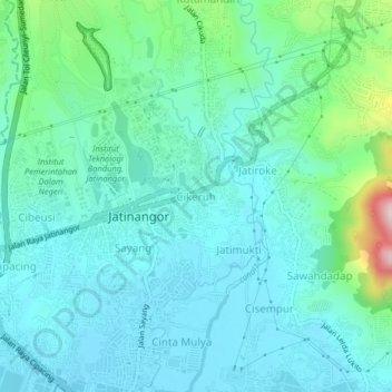
Name: Cikeruh topographic map, elevation, terrain.
Location: Cikeruh, Sumedang, West Java, Java, 45363, Indonesia (-6.95235 107.75819 -6.91235 107.79819)
Average elevation: 2,457 ft
Minimum elevation: 2,208 ft
Maximum elevation: 3,547 ft
Thank you for supporting this site ❤️
Make a donation
Make a donation
Gear up for your next adventure:
As an Amazon Associate, this site earns from qualifying purchases at no extra cost to you.