
Rankin topographic map
Interactive map
Click on the map to display elevation.
About this map
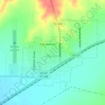
Name: Rankin topographic map, elevation, terrain.
Location: Rankin, Upton County, Texas, United States (31.21717 -101.95087 31.23420 -101.92806)
Average elevation: 2,543 ft
Minimum elevation: 2,477 ft
Maximum elevation: 2,690 ft
Other topographic maps
Click on a map to view its topography, its elevation and its terrain.
Midkiff
United States > Texas > Upton County
Midkiff, Upton County, Texas, 79755, United States
Average elevation: 2,730 ft