
Manns Peak topographic map
Interactive map
Click on the map to display elevation.
About this map
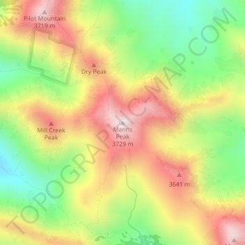
Name: Manns Peak topographic map, elevation, terrain.
Location: Manns Peak, Grand County, Utah, United States (38.51497 -109.22257 38.51507 -109.22247)
Average elevation: 11,243 ft
Minimum elevation: 10,246 ft
Maximum elevation: 12,267 ft
Other topographic maps
Click on a map to view its topography, its elevation and its terrain.
Moab
United States > Utah > Grand County
Moab, Grand County, Utah, 84532, United States
Average elevation: 4,452 ft
Castle Valley
United States > Utah > Grand County
Castle Valley, Grand County, Utah, United States
Average elevation: 5,282 ft
Castleton Tower
United States > Utah > Grand County
Castleton Tower, Grand County, Utah, United States
Average elevation: 5,082 ft
Arches National Park
United States > Utah > Grand County
Arches National Park, Grand County, Utah, United States
Average elevation: 4,843 ft