
Thank you for supporting this site ❤️
Make a donation
Make a donation
Gear up for your next adventure:
As an Amazon Associate, this site earns from qualifying purchases at no extra cost to you.
Artern topographic map
Click on the map to display elevation.
Thank you for supporting this site ❤️
Make a donation
Make a donation
Gear up for your next adventure:
As an Amazon Associate, this site earns from qualifying purchases at no extra cost to you.
About this map
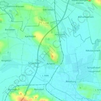
Name: Artern topographic map, elevation, terrain.
Location: Artern, Kyffhäuserkreis, Thuringia, 06556, Germany (51.34167 11.23891 51.41031 11.40156)
Average elevation: 430 ft
Minimum elevation: 381 ft
Maximum elevation: 784 ft
Thank you for supporting this site ❤️
Make a donation
Make a donation
Gear up for your next adventure:
As an Amazon Associate, this site earns from qualifying purchases at no extra cost to you.
Other topographic maps
Click on a map to view its topography, its elevation and its terrain.
Unterburg
Germany > Thuringia > Kyffhäuserkreis > Kyffhäuserland > Kohlstätte
Average elevation: 988 ft