
Make a donation
Gear up for your next adventure:
As an Amazon Associate, this site earns from qualifying purchases at no extra cost to you.
Becker topographic map
Click on the map to display elevation.
Make a donation
Gear up for your next adventure:
As an Amazon Associate, this site earns from qualifying purchases at no extra cost to you.
About this map
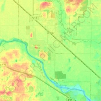
Name: Becker topographic map, elevation, terrain.
Location: Becker, Sherburne County, Minnesota, United States (45.32463 -93.92062 45.42612 -93.81992)
Average elevation: 968 ft
Minimum elevation: 892 ft
Maximum elevation: 1,056 ft
Sherburne County trails, hiking, mountain biking, running and outdoor activities
Make a donation
Gear up for your next adventure:
As an Amazon Associate, this site earns from qualifying purchases at no extra cost to you.
Other topographic maps
Click on a map to view its topography, its elevation and its terrain.
Elk River
United States > Minnesota > Sherburne County > Elk River > Elk River
Average elevation: 919 ft