
Thank you for supporting this site ❤️
Make a donation
Make a donation
Gear up for your next adventure:
As an Amazon Associate, this site earns from qualifying purchases at no extra cost to you.
Lüganuse vald topographic map
Click on the map to display elevation.
Thank you for supporting this site ❤️
Make a donation
Make a donation
Gear up for your next adventure:
As an Amazon Associate, this site earns from qualifying purchases at no extra cost to you.
About this map
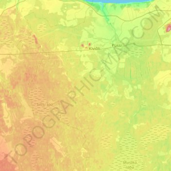
Name: Lüganuse vald topographic map, elevation, terrain.
Location: Lüganuse vald, Ida-Viru maakond, Estonia (59.14160 26.70233 59.43916 27.22215)
Average elevation: 200 ft
Minimum elevation: 0 ft
Maximum elevation: 492 ft
Thank you for supporting this site ❤️
Make a donation
Make a donation
Gear up for your next adventure:
As an Amazon Associate, this site earns from qualifying purchases at no extra cost to you.