
Thank you for supporting this site ❤️
Make a donation
Make a donation
Gear up for your next adventure:
As an Amazon Associate, this site earns from qualifying purchases at no extra cost to you.
Tandsbyn topographic map
Click on the map to display elevation.
Thank you for supporting this site ❤️
Make a donation
Make a donation
Gear up for your next adventure:
As an Amazon Associate, this site earns from qualifying purchases at no extra cost to you.
About this map
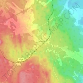
Name: Tandsbyn topographic map, elevation, terrain.
Location: Tandsbyn, Östersunds kommun, Jämtland County, Sweden (62.98092 14.72531 63.02092 14.76531)
Average elevation: 1,247 ft
Minimum elevation: 1,073 ft
Maximum elevation: 1,401 ft
Thank you for supporting this site ❤️
Make a donation
Make a donation
Gear up for your next adventure:
As an Amazon Associate, this site earns from qualifying purchases at no extra cost to you.