
Thank you for supporting this site ❤️
Make a donation
Make a donation
Gear up for your next adventure:
As an Amazon Associate, this site earns from qualifying purchases at no extra cost to you.
Ebnet topographic map
Click on the map to display elevation.
Thank you for supporting this site ❤️
Make a donation
Make a donation
Gear up for your next adventure:
As an Amazon Associate, this site earns from qualifying purchases at no extra cost to you.
About this map
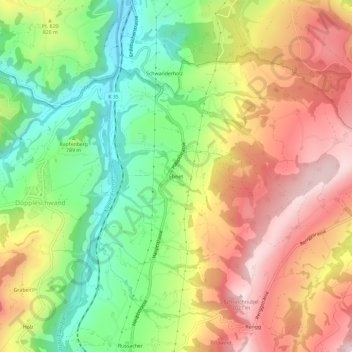
Name: Ebnet topographic map, elevation, terrain.
Location: Ebnet, Entlebuch, Luzern, 6163, Schweiz (47.00108 8.05794 47.04108 8.09794)
Average elevation: 2,602 ft
Minimum elevation: 1,919 ft
Maximum elevation: 3,323 ft
Thank you for supporting this site ❤️
Make a donation
Make a donation
Gear up for your next adventure:
As an Amazon Associate, this site earns from qualifying purchases at no extra cost to you.