
Thank you for supporting this site ❤️
Make a donation
Make a donation
Gear up for your next adventure:
As an Amazon Associate, this site earns from qualifying purchases at no extra cost to you.
Firiza topographic map
Click on the map to display elevation.
Thank you for supporting this site ❤️
Make a donation
Make a donation
Gear up for your next adventure:
As an Amazon Associate, this site earns from qualifying purchases at no extra cost to you.
About this map
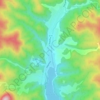
Name: Firiza topographic map, elevation, terrain.
Location: Firiza, Baia Mare, Maramureș, 430002, Romania (47.72889 23.58495 47.76889 23.62495)
Average elevation: 1,693 ft
Minimum elevation: 1,191 ft
Maximum elevation: 2,664 ft
Thank you for supporting this site ❤️
Make a donation
Make a donation
Gear up for your next adventure:
As an Amazon Associate, this site earns from qualifying purchases at no extra cost to you.