
Thank you for supporting this site ❤️
Make a donation
Make a donation
Gear up for your next adventure:
As an Amazon Associate, this site earns from qualifying purchases at no extra cost to you.
Stiappa topographic map
Click on the map to display elevation.
Thank you for supporting this site ❤️
Make a donation
Make a donation
Gear up for your next adventure:
As an Amazon Associate, this site earns from qualifying purchases at no extra cost to you.
About this map
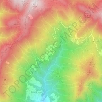
Name: Stiappa topographic map, elevation, terrain.
Location: Stiappa, Pescia, Pistoia, Tuscany, 51017, Italy (43.97291 10.68991 44.01291 10.72991)
Average elevation: 2,421 ft
Minimum elevation: 974 ft
Maximum elevation: 3,655 ft
Thank you for supporting this site ❤️
Make a donation
Make a donation
Gear up for your next adventure:
As an Amazon Associate, this site earns from qualifying purchases at no extra cost to you.