Geolocate

Origo topographic map

Click on the map to display elevation.

About this map

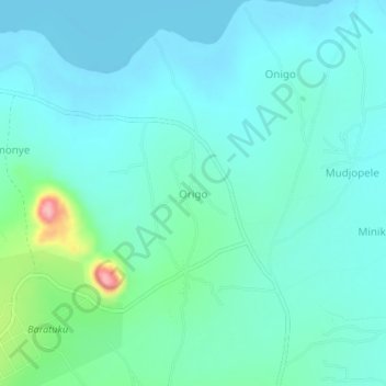
Name: Origo topographic map, elevation, terrain.

Location: Origo, Adjumani, Northern Region, Uganda (3.46520 31.88152 3.50520 31.92152)

Average elevation: 2,100 ft

Minimum elevation: 2,018 ft

Maximum elevation: 2,493 ft

Gear up for your next adventure:

🪶Wildlife Field Guides - Learn animal tracking and species ID
🧭Orienteering Set - Complete compass and map reading kit
Solar GPS Watches - Advanced multisport watches with built-in topographic maps
📡GPS Antenna Upgrade - Enhance GPS reception in remote terrain
🦟Ultrasonic Repellers - Create a bug-free zone at your camp or rest stop

As an Amazon Associate, this site earns from qualifying purchases at no extra cost to you.