
Thank you for supporting this site ❤️
Make a donation
Make a donation
Gear up for your next adventure:
As an Amazon Associate, this site earns from qualifying purchases at no extra cost to you.
Srinagar topographic map
Click on the map to display elevation.
Thank you for supporting this site ❤️
Make a donation
Make a donation
Gear up for your next adventure:
As an Amazon Associate, this site earns from qualifying purchases at no extra cost to you.
About this map
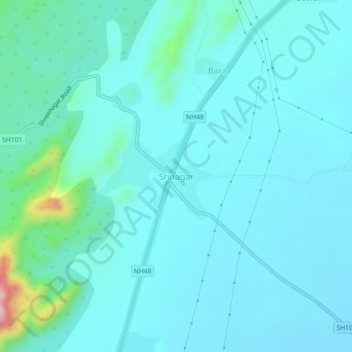
Name: Srinagar topographic map, elevation, terrain.
Location: Srinagar, Nasirabad Tehsil, Ajmer, Rajasthan, 305525, India (26.41461 74.76100 26.45461 74.80100)
Average elevation: 1,539 ft
Minimum elevation: 1,414 ft
Maximum elevation: 2,402 ft
Thank you for supporting this site ❤️
Make a donation
Make a donation
Gear up for your next adventure:
As an Amazon Associate, this site earns from qualifying purchases at no extra cost to you.