
Thank you for supporting this site ❤️
Make a donation
Make a donation
Gear up for your next adventure:
As an Amazon Associate, this site earns from qualifying purchases at no extra cost to you.
Gaglioli topographic map
Click on the map to display elevation.
Thank you for supporting this site ❤️
Make a donation
Make a donation
Gear up for your next adventure:
As an Amazon Associate, this site earns from qualifying purchases at no extra cost to you.
About this map
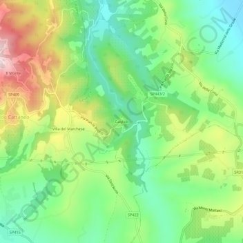
Name: Gaglioli topographic map, elevation, terrain.
Location: Gaglioli, Bevagna, Perugia, Umbria, 06031, Italia (42.88864 12.56103 42.92864 12.60103)
Average elevation: 1,125 ft
Minimum elevation: 659 ft
Maximum elevation: 1,890 ft
Thank you for supporting this site ❤️
Make a donation
Make a donation
Gear up for your next adventure:
As an Amazon Associate, this site earns from qualifying purchases at no extra cost to you.