Geolocate

Batalik topographic map

Click on the map to display elevation.

About this map

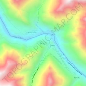
Name: Batalik topographic map, elevation, terrain.

Location: Batalik, Kargil Tehsil, Ladakh, India (34.63577 76.31943 34.67577 76.35943)

Average elevation: 10,082 ft

Minimum elevation: 8,451 ft

Maximum elevation: 12,461 ft

Gear up for your next adventure:

🔌Solar Panel Charger - Charge gear sustainably outdoors
🪑Ultralight Camp Chairs - Portable seating for resting after a long day of mapping
🎒Outdoor Daypacks - Lightweight backpacks designed for carrying maps and essential gear
🪶Wildlife Field Guides - Learn animal tracking and species ID
🚑Emergency Bivvies - Heat-reflective sleeping bags for survival situations

As an Amazon Associate, this site earns from qualifying purchases at no extra cost to you.