
Thank you for supporting this site ❤️
Make a donation
Make a donation
Gear up for your next adventure:
As an Amazon Associate, this site earns from qualifying purchases at no extra cost to you.
Baiwu topographic map
Click on the map to display elevation.
Thank you for supporting this site ❤️
Make a donation
Make a donation
Gear up for your next adventure:
As an Amazon Associate, this site earns from qualifying purchases at no extra cost to you.
About this map
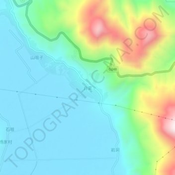
Name: Baiwu topographic map, elevation, terrain.
Location: Baiwu, Huize County, Qujing City, Yunnan, China (26.46670 103.17400 26.50670 103.21400)
Average elevation: 6,900 ft
Minimum elevation: 6,299 ft
Maximum elevation: 8,681 ft
Thank you for supporting this site ❤️
Make a donation
Make a donation
Gear up for your next adventure:
As an Amazon Associate, this site earns from qualifying purchases at no extra cost to you.