
Thank you for supporting this site ❤️
Make a donation
Make a donation
Gear up for your next adventure:
As an Amazon Associate, this site earns from qualifying purchases at no extra cost to you.
Sarqan topographic map
Click on the map to display elevation.
Thank you for supporting this site ❤️
Make a donation
Make a donation
Gear up for your next adventure:
As an Amazon Associate, this site earns from qualifying purchases at no extra cost to you.
About this map
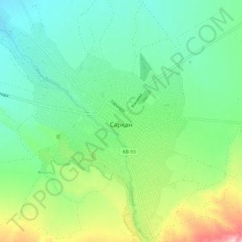
Name: Sarqan topographic map, elevation, terrain.
Location: Sarqan, Sarqan District, Jetisu Region, Kazakhstan (45.38170 79.86667 45.44159 79.93924)
Average elevation: 2,539 ft
Minimum elevation: 2,297 ft
Maximum elevation: 3,143 ft
Thank you for supporting this site ❤️
Make a donation
Make a donation
Gear up for your next adventure:
As an Amazon Associate, this site earns from qualifying purchases at no extra cost to you.