
Thank you for supporting this site ❤️
Make a donation
Make a donation
Gear up for your next adventure:
As an Amazon Associate, this site earns from qualifying purchases at no extra cost to you.
Kurdufan topographic map
Click on the map to display elevation.
Thank you for supporting this site ❤️
Make a donation
Make a donation
Gear up for your next adventure:
As an Amazon Associate, this site earns from qualifying purchases at no extra cost to you.
About this map
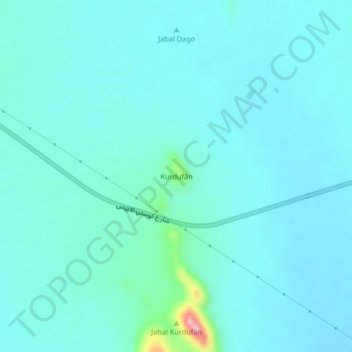
Name: Kurdufan topographic map, elevation, terrain.
Location: Kurdufan, Bara, North Kordofan State, Sudan (13.06333 30.33000 13.10333 30.37000)
Average elevation: 1,896 ft
Minimum elevation: 1,814 ft
Maximum elevation: 2,516 ft
Thank you for supporting this site ❤️
Make a donation
Make a donation
Gear up for your next adventure:
As an Amazon Associate, this site earns from qualifying purchases at no extra cost to you.