
Make a donation
Gear up for your next adventure:
As an Amazon Associate, this site earns from qualifying purchases at no extra cost to you.
Lieth topographic map
Click on the map to display elevation.
Make a donation
Gear up for your next adventure:
As an Amazon Associate, this site earns from qualifying purchases at no extra cost to you.
About this map
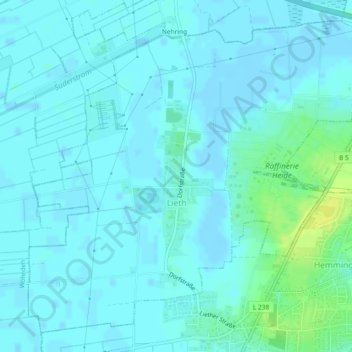
Name: Lieth topographic map, elevation, terrain.
Average elevation: 13 ft
Minimum elevation: -10 ft
Maximum elevation: 62 ft
Make a donation
Gear up for your next adventure:
As an Amazon Associate, this site earns from qualifying purchases at no extra cost to you.
Other topographic maps
Click on a map to view its topography, its elevation and its terrain.
Dammsknöll
Deutschland > Schleswig-Holstein > Kreis Dithmarschen > Offenbüttel
Average elevation: 20 ft
Trennewurtherneuendeich
Deutschland > Schleswig-Holstein > Kreis Dithmarschen > Trennewurth
Average elevation: 3 ft
Trischen
Deutschland > Schleswig-Holstein > Kreis Dithmarschen > Friedrichskoog
Trischen liegt inmitten einer Kette von Hochsanden, die sich an der deutschen Nordseeküste von der Eider- bis zur Wesermündung hinziehen und westlich der Weser in die Ostfriesischen und Westfriesischen Barriereinseln übergehen. Direkt nördlich von Trischen liegen die beiden Hochsande Tertius und Blauort.…
Average elevation: 0 ft
Make a donation
Gear up for your next adventure:
As an Amazon Associate, this site earns from qualifying purchases at no extra cost to you.
Tiebensee
Deutschland > Schleswig-Holstein > Kreis Dithmarschen > Neuenkirchen
Average elevation: 7 ft
Make a donation
Gear up for your next adventure:
As an Amazon Associate, this site earns from qualifying purchases at no extra cost to you.