Geolocate

Gmain topographic map

Click on the map to display elevation.

About this map

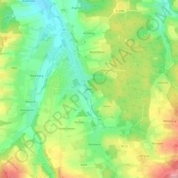
Name: Gmain topographic map, elevation, terrain.

Location: Gmain, Isen, Landkreis Erding, Bayern, 84424, Deutschland (48.18546 12.04554 48.22546 12.08554)

Average elevation: 1,775 ft

Minimum elevation: 1,601 ft

Maximum elevation: 2,011 ft

Gear up for your next adventure:

🛡️Insect Repellent - Protection against bugs during outdoor activities
Backpacking Tents - Weight-optimized shelters for multi-day topographic surveys
🔭Stargazing Telescopes - Perfect for camping in low-light pollution areas shown on maps
🚁Photography Drones - Capture stunning aerial views of landforms and topography
🛰️Handheld GPS Units - Professional satellite navigators for precise backcountry mapping

As an Amazon Associate, this site earns from qualifying purchases at no extra cost to you.